One of the most costly mistakes a contractor can make in Springfield is assuming that the stiff residual clays and weathered limestone of the Ozark Plateau will behave predictably once a 25-foot cut is opened. The transition zone between the red clay residuum and the underlying Mississippian limestone — particularly within the Burlington-Keokuk formation — often contains solution-widened joints and clay-filled cavities that redistribute groundwater in unexpected ways. When these features intersect an excavation face, the pore pressure regime can shift within hours, triggering raveling or block falls that no standard slope stability analysis predicted. We have seen this scenario unfold on projects near the James River Freeway corridor, where a dewatering-induced settlement affected adjacent structures simply because the monitoring plan was not designed to capture differential response across the soil-rock interface. The solution is not more conservative shoring — it is a disciplined excavation monitoring program that tracks displacement, water pressure, and vibration in real time, feeding data back into the design through an observational method framework aligned with ASCE 7-22 and local IBC amendments.
In the Springfield karst environment, the most dangerous excavation condition is not the one that fails — it is the one that moves silently for three days before exceeding a threshold no one was measuring.
Our approach and scope
Local considerations
Springfield's population surpassed 170,000 in 2023, driving a wave of infill development and basement excavations in neighborhoods like Rountree and Phelps Grove where century-old homes sit 15 feet from the property line. The risk profile here is dominated by two factors: karst unpredictability and low public tolerance for construction-induced damage. A 2022 project near Missouri State University required real-time monitoring after a borehole camera revealed an 18-inch-wide dissolution feature crossing the proposed shoring alignment at a 40-degree angle — a condition that would have remained undetected with a conventional borings-only investigation. When you combine these geologic surprises with the fact that Springfield lies within Seismic Design Category C per IBC (with contributions from the New Madrid Seismic Zone approximately 200 miles to the southeast), the case for continuous monitoring becomes undeniable. A moderate seismic event during an open-cut phase could degrade the excavation face through a mechanism completely separate from the static design assumptions, and only live instrumentation will capture the post-event condition rapidly enough to guide a safe re-entry decision.
Relevant standards
ASCE 7-22 Minimum Design Loads and Associated Criteria for Buildings and Other Structures (Chapter 34, Excavation Monitoring), IBC 2021 Section 3304 (Excavations, Observational Method provisions), OSHA 29 CFR 1926 Subpart P (Excavations — Competent Person requirements for monitoring during active cuts), USBM RI 8507 (Ground vibration thresholds for adjacent structures), ASTM D6230 (Standard Practice for Monitoring Well Installation with Automated Sensors)
Complementary services
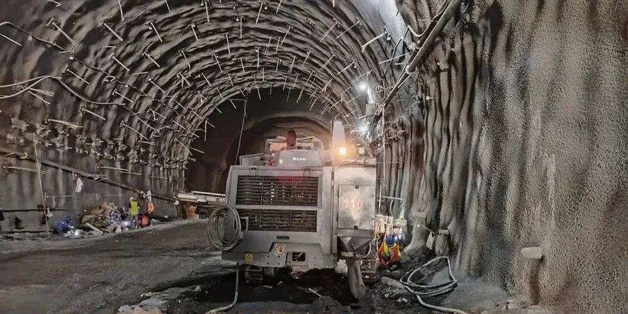
Deep Excavation Monitoring (Urban Cuts)
Designed for supported excavations deeper than 15 feet in Springfield's commercial corridors. Combines inclinometer casings behind soldier pile and lagging walls, optical survey of settlement points on adjacent sidewalks and building foundations, and piezometer arrays to track dewatering effectiveness. Data is reviewed daily by a licensed geotechnical engineer.
Vibration and Crack Monitoring Programs
Required when rock excavation or heavy compaction occurs within 100 feet of occupied structures. We install triaxial geophones and seismographs calibrated to ISEE standards, plus tell-tale crack gauges on pre-surveyed masonry cracks. Pre-construction condition surveys are conducted jointly with property owners to document baseline conditions.
Karst-Specific Instrumentation Packages
For sites where the geophysical survey or exploratory drilling program has identified potential karst features beneath or adjacent to the excavation footprint. We deploy nested vibrating wire piezometers at multiple depths to detect hydraulic communication between the excavation zone and deeper conduits, coupled with periodic dye-trace verification when groundwater changes are detected.
Typical parameters
Common questions
What is the typical cost range for an excavation monitoring program on a commercial project in Springfield?
For a typical commercial excavation in Springfield lasting 8 to 16 weeks, the monitoring program — including instrumentation rental, installation, automated data acquisition, and weekly engineering review — typically ranges from US$880 to US$2,200 per week depending on the number of sensor types and the complexity of the alerting protocol. Single-family basement projects with a simplified monitoring plan sit at the lower end, while deep mixed-use excavations requiring inclinometer arrays, multiple piezometers, and vibration monitoring near historic structures fall at the upper end.
How do you handle the observational method when monitoring data exceeds threshold values?
The observational method under ASCE 7-22 requires a pre-established action plan — not a reactive scramble. Our monitoring programs define amber alerts at 75% of the design deformation or pressure limit, which trigger a mandatory engineering review within 24 hours. Red alerts at 95% require immediate suspension of excavation activities in the affected zone and implementation of contingency measures that were designed and approved before the project began. These contingencies might include supplemental dewatering, additional strut levels, or localized ground improvement, all of which are documented in the project's baseline report prior to breaking ground.
What makes Springfield's geology particularly challenging for excavation monitoring compared to other parts of Missouri?
The Springfield Plateau introduces a dual-porosity system — the primary porosity of the residual clay matrix and the secondary porosity of solution-enlarged fractures and conduits in the underlying limestone — that creates highly anisotropic groundwater flow paths. A piezometer installed 10 feet from an excavation face may show no response to dewatering on the opposite side of a clay-filled grike, while a cavity 30 feet away transmits pressure changes almost instantly. Our instrumentation layouts account for this by using closely spaced, multi-level piezometer nests and by correlating real-time data with the detailed karst feature map developed during the pre-construction geophysical survey.
How soon before excavation begins should the monitoring system be installed?
We recommend that inclinometer casings and piezometers be installed at least two weeks prior to the start of major excavation activities, and that automated total station monitoring of neighboring structures begins no less than one month before any ground-disturbing work. This lead time establishes a reliable baseline for seasonal groundwater fluctuations and ambient vibration levels (from traffic on National Avenue or Glenstone Avenue, for example). Without this baseline, it becomes very difficult to distinguish construction-induced response from normal environmental variation, and the resulting false positives can erode trust with adjacent property owners and unnecessarily delay the project.