In Springfield Missouri, the first thing a geotechnical team notices on a hillside site isn't the slope angle — it's the water. Decades of work on the Burlington‑Keokuk Limestone residuum have taught us that a stability failure here almost always starts with a perched water table that nobody mapped during the initial site walk. The cherty red clay looks competent in a dry August, but after a wet March its effective cohesion can drop below 200 psf, and that's when a 2H:1V cut that stood for years suddenly unravels. Because Springfield sits on the Springfield Plateau, the bedrock surface is riddled with paleokarst features that concentrate groundwater in ways a simple infinite‑slope model will miss. We run our slope stability analysis programs with site‑specific pore pressure ratios measured from piezometers installed into the clay‑over‑limestone contact, not textbook ru values. That approach has kept warehouse pads and subdivision lots stable through some of the wettest springs on record in Greene County.
In Springfield residuum, drained friction angles measured below 18 degrees on slickensided clay demand a factor of safety above 1.5 for permanent cuts — anything less invites a wet‑season reactivation.
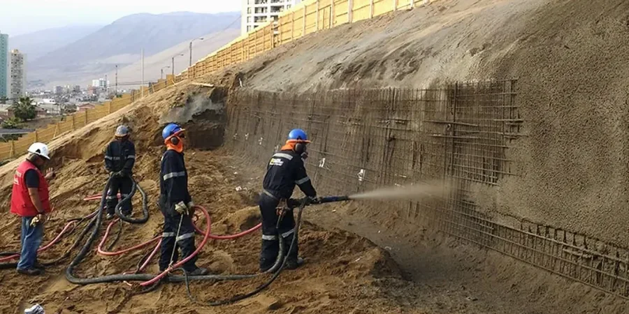
Our approach and scope
Local considerations
The biggest analytical blind spot in the Springfield Plateau is the role of solution‑widened joints. Even when a boring log shows N‑values above 30 in the upper limestone, a single clay‑filled grike dipping out of the cut face can daylight after heavy rain and act as a pre‑defined failure plane. We address this by running back‑analysis on nearby road cuts along US 65 and Route 13, where MDOT has documented wedge failures triggered by joint‑controlled infiltration. The risk isn't theoretical — the 2015 landslide that closed a section of Farm Road 141 near Wilson's Creek traced directly to a perched water lens in a buried sinkhole that the original subdivision grading plan never identified. Our field mapping now includes electrical resistivity transects across every proposed cut where the depth to pinnacled rock is less than 20 feet, specifically to locate these conduits before they become a stability problem.
Explanatory video
Relevant standards
IBC 2021 – Chapter 18, Soils and Foundations, ASCE 7‑22 – Minimum Design Loads (seismic provisions for New Madrid region), ASTM D6467 – Ring Shear Test for residual strength, Missouri Geological Survey – Surficial Materials and Landslide Inventory Maps, USGS NSHM 2014/2023 – Seismic hazard parameters for Greene County
Complementary services
Karst Feature Reconnaissance
Ground truthing of sinkholes and lineaments using historical aerial photography, LiDAR hillshade, and on‑foot mapping to identify karst conduits that undermine slope stability calculations.
Laboratory Shear Strength Suite
Direct shear on undisturbed Shelby tube samples plus ring shear on remolded clay fractions to define the full peak‑to‑residual strength envelope for Springfield residuum.
Pseudo‑Static & Deformation Analysis
Newmark sliding block displacement assessment for critical slopes where IBC‑required kh values indicate accumulated deformation could threaten adjacent structures.
Drainage & Reinforcement Design
Horizontal drain arrays, trench drains, and soil nail layouts integrated with the stability model to achieve the target factor of safety without over‑excavating the toe.
Typical parameters
Common questions
What factor of safety is required for a permanent cut slope in Springfield?
IBC Chapter 18 and local practice in Greene County set a minimum static factor of safety of 1.5 for permanent slopes where failure could impact structures. For pseudo‑static conditions, 1.1 is the minimum, provided the Newmark displacement remains under 2 inches. The Missouri Geological Survey landslide inventory shows that slopes designed below 1.3 in residuum have a higher rate of wet‑season movement.
How does the karst geology of the Springfield Plateau affect slope stability?
Paleokarst features — buried sinkholes, grikes, and solution‑widened joints in the Burlington‑Keokuk Limestone — create preferential groundwater pathways that raise pore pressure locally. A slope that analyzes as stable under uniform seepage can fail if a clay‑filled karst conduit daylights in the cut face. We map these features with resistivity and auger refusal patterns before running the limit‑equilibrium model.
What is the typical cost range for a slope stability analysis in Springfield Missouri?
A complete analysis with two boreholes, laboratory shear testing, piezometer installation, and the stability report typically falls between US$1,290 and US$3,720, depending on slope height, access constraints, and whether ring shear or Newmark analysis is required. Complex sites with multiple cross‑sections or karst mapping needs trend toward the upper end.
Do Springfield slopes require seismic analysis even though Missouri is not California?
Yes. The New Madrid Seismic Zone imposes a short‑period spectral acceleration of about 0.18g on Site Class D in Greene County, which is significant enough to trigger pseudo‑static analysis under ASCE 7‑22. The IBC requires seismic slope stability checks for cuts over 15 feet when the mapped Ss exceeds 0.15g, which it does across all of Springfield.