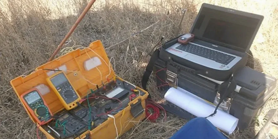
We roll out the 4-electrode array and hammer stainless steel stakes into the clay-rich residuum that covers much of the Springfield Plateau. The resistivity meter cycles through the Wenner and Schlumberger configurations, injecting current and reading potential difference at each spacing. Springfield sits at 1,300 feet elevation where Mississippian limestone meets weathered chert — a layered profile that reads clearly on a VES curve. We set up along planned building footprints, retention basin alignments, and roadway centerlines. Each sounding gives us apparent resistivity versus depth before we invert the data into a true layered model. For deeper targets we pull longer spreads, sometimes 600 feet or more, to reach the top of rock where test pits confirm the transition from stiff clay to pinnacled limestone.
Resistivity imaging catches karst features that random borings miss — essential in Springfield's pinnacled limestone terrain.
Our approach and scope
Local considerations
IBC Chapter 18 and ASCE 7 require subsurface investigation to address erratic rock conditions, and Springfield's karst makes this non-negotiable. The city sits on the Springfield Plateau section of the Ozark aquifer, where groundwater moves through solution-enlarged fractures and creates sinkhole-prone ground. A foundation bearing on a thin limestone roof over a mud-filled cavity will settle — sometimes suddenly. We apply resistivity profiling to map those cavities before the structural engineer locks in footing elevations. On one recent commercial project near the James River Freeway, the VES data showed a low-resistivity zone at 22 feet directly under the proposed elevator pit. The design team shifted the pit eight feet and avoided a costly undercut. In Springfield Missouri, skipping geophysics before foundation design isn't a risk calculation — it's a liability.
Relevant standards
ASTM D6431 Standard Guide for Using the Direct Current Resistivity Method, IBC Chapter 18 Soils and Foundations, ASCE 7 Minimum Design Loads for Buildings, ASTM D1586 Standard Test Method for SPT, ASTM D2487 Classification of Soils for Engineering Purposes
Complementary services
2D Electrical Resistivity Profiling
Multi-electrode surveys along linear transects for foundation design, sinkhole investigation, and cut-fill transition mapping.
VES Soundings (Vertical Electrical Sounding)
Single-point Schlumberger soundings to depth-stack resistivity layers. Used for borrow source evaluation and bedrock depth estimation.
Karst Void Detection Surveys
Grid-based resistivity mapping to locate solution cavities, clay-filled fractures, and pinnacled rock beneath proposed structures in Springfield's limestone terrain.
Earth Resistivity for Grounding Design
Wenner array measurements per IEEE 81 to determine soil resistivity for substation grounding grids and lightning protection systems.
Typical parameters
Common questions
What depth can a VES survey reach in Springfield's geology?
Depth of investigation depends on the maximum current electrode spacing. With a 600-foot AB/2 spread we typically reach 80 to 100 feet in the clay-over-limestone profile common around Springfield. Deeper targets require longer spreads and more power. We size the array to the project depth requirement.
How do you distinguish a water-filled void from a dry cave?
Water-filled voids show low resistivity — often below 50 ohm-m — because dissolved ions make the water conductive. Air-filled caves read as very high resistivity anomalies, sometimes over 1,000 ohm-m, since air is an insulator. The contrast against background limestone resistivity tells us which type of void we are looking at.
What does a resistivity survey cost for a typical Springfield commercial lot?
For a standard commercial lot survey with 4 to 6 parallel lines and a target depth of 40 to 50 feet, budget US$690 to US$900 depending on line spacing, total lineal footage, and site access conditions. We quote firm after reviewing the site plan.
Can resistivity surveys work around buried utilities on site?
Yes, but we need utility clearance before we stake electrodes. Buried metal pipes and conduits create conductive shorts that distort the data. We offset lines away from known utilities and note any remaining interference in the report. Springfield's one-call system handles the locate requests before our crew arrives.